The Evolution of Scan-to-BIM Technology in Utility Mapping
Revolutionizing Infrastructure: Innovations in Scan-to-BIM for Underground Utilities Mapping
Underground utility mapping is crucial for the planning, design, and maintenance of infrastructure, ensuring that projects avoid costly and dangerous conflicts with existing utilities. Innovations in Scan-to-BIM technology have significantly transformed how these underground systems are detected, mapped, and managed. This advanced technology offers precise, real-time data that enhances accuracy and efficiency, reducing the risk of errors that could lead to project delays or safety hazards.
By integrating Scan-to-BIM into utility mapping processes, engineers and planners can visualize complex underground networks with unprecedented clarity. This not only streamlines workflows but also facilitates better decision-making throughout the project’s lifecycle. Furthermore, adopting these innovations can lead to substantial cost savings by minimizing the likelihood of unforeseen utility strikes and associated repairs. Embracing Scan-to-BIM technology is a forward-thinking approach that ensures infrastructure projects are completed on time, within budget, and with enhanced safety measures in place.
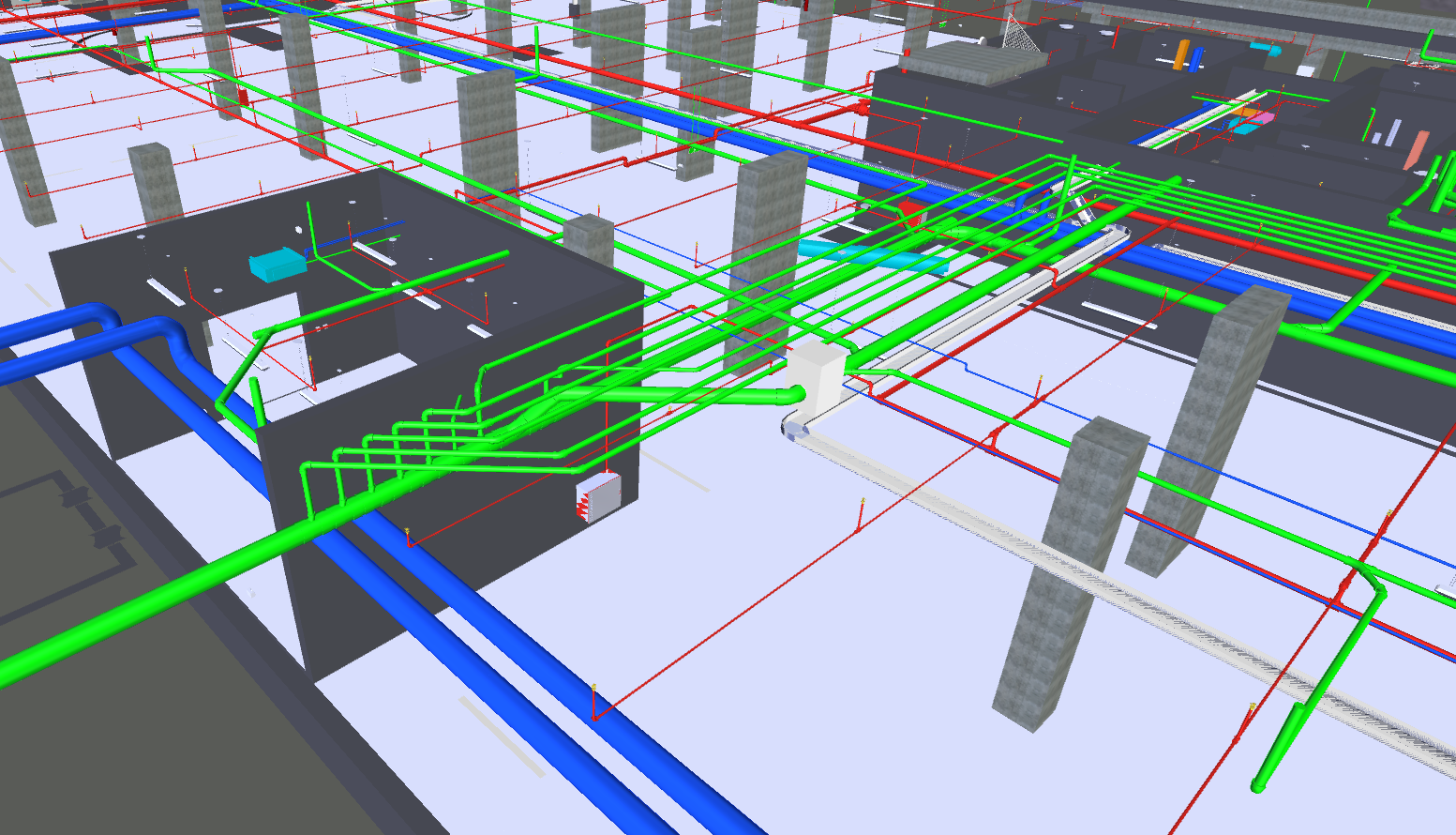
The management of underground utilities, a complex maze of pipes, cables, and conduits, has always been a major obstacle to construction and infrastructure projects. This often leads to costly delays due to incorrect or incomplete records and dangerous hits on utility lines. Scan-to-BIM technology has revolutionized the mapping of this hidden world with highly accurate digital methods. By integrating state-of-the-art scanning techniques into BIM platforms, this approach creates sophisticated three-dimensional (3D) models of subsurface networks.
This article discusses the latest innovations in Scan-to-BIM, including technologies, software, and real-life applications that are changing our understanding and interaction with underground landscapes. .
One of the most significant advancements in Scan-to-BIM technology is the use of ground-penetrating radar (GPR) and LiDAR systems. These technologies enable precise detection and mapping of underground utilities, capturing even the most intricate details that traditional methods might miss. When combined with advanced software platforms, these scans are transformed into comprehensive 3D models that provide an accurate representation of existing conditions. Such innovations not only reduce the risk of accidental utility strikes but also enhance project efficiency by allowing engineers and planners to visualize potential conflicts before breaking ground.
This foresight leads to more informed decision-making, ultimately saving time and resources that would otherwise be lost due to unforeseen complications.
Real-life applications have demonstrated how Scan-to-BIM can streamline processes across various sectors, from urban development projects to the maintenance of aging infrastructure. Cities around the world are adopting this technology to better manage their underground assets, improving safety standards while optimizing resource allocation. In conclusion, embracing Scan-to-BIM technology is not just a step forward for construction and engineering industries—it’s a necessary evolution towards smarter urban planning and sustainable growth. By investing in these cutting-edge tools today, we can pave the way for more resilient infrastructures that meet both current demands and future challenges efficiently.
Here’s how modern technology is shaping this field:
Key Technologies in Modern Scan to BIM
Laser Scanning (LiDAR): LiDAR technology uses light in the form of a pulsed laser to measure variable distances to the Earth. This technology is highly effective in capturing high-resolution images of complex environments, including the surface details necessary for underground utility mapping.
Ground Penetrating Radar (GPR): GPR systems are indispensable for underground utility mapping. They use radar pulses to image the subsurface, effectively identifying and mapping different types of utilities, including non-conductive materials like plastic and concrete, which are invisible to other types of sensors.
Photogrammetry: This technique uses photography to measure and record the exact positions of surface points. Although primarily used for above-ground mapping, photogrammetry can also assist in the preliminary planning stages of utility mapping by providing detailed surface conditions.
Data Fusion: Combining data from multiple sources (like LiDAR, GPR, and photogrammetry) enhances the accuracy of the utility maps. Data fusion helps in creating a comprehensive view of both the surface and subsurface environments, which is crucial for complex urban areas.
Point Cloud Processing: Modern advancements in software and algorithms have greatly improved point cloud processing. These advancements allow for the faster transformation of raw data into usable 3D models and provide tools for better handling and analysis of massive datasets.
Advancements in Software and Algorithms
Improved software and algorithms are central to the advancements in Scan-to-BIM technology. These innovations include:
– Enhanced Data Accuracy: New algorithms help in refining the data extracted from scanning technologies, reducing errors, and increasing precision.
– Faster Processing: Modern software can handle large datasets more efficiently, speeding up the processing time from data capture to model creation.
– Better Integration: Current software solutions offer better integration capabilities with other CAD and BIM tools, facilitating smoother workflows and better collaboration across different teams.
Real-World Applications and Case Studies
Urban Infrastructure Projects: In densely populated cities, Scan-to-BIM technologies are used to map underground utilities to avoid disruptions during construction activities. For instance, in New York City, Scan-to-BIM practices have been employed to map the complex network of subways, sewages, and utility lines during various subway extension projects.
Renovation of Historical Sites: At historical sites, where preservation is as crucial as renovation, Scan-to-BIM technologies like GPR help in identifying existing utilities without disturbing the site integrity. An example includes the renovation projects in ancient European cities where underground utilities needed to be mapped and updated without affecting the historical architecture.
Disaster Management: After natural disasters, rapid mapping of affected areas is crucial for effective disaster management and recovery. Scan-to-BIM technologies facilitate quick assessment and reconstruction planning of damaged infrastructure, including buried utilities.
The continuous innovation in Scan-to-BIM technologies for underground utilities mapping not only enhances the efficiency and safety of construction projects but also plays a vital role in maintaining the delicate balance between modern infrastructure demands and historical preservation. As these technologies evolve, they promise to deliver even greater capabilities and broader applications, further transforming the AEC industry.


